
September 2024: St. Louis River Area of Concern Updates
The St. Louis River (SLR) was designated as one of the 31 Areas of Concern (AOC) on the Great Lakes. It was designated as an AOC under the U.S. – Canada Great Lakes Water Quality Agreement in 1987 because of significant impacts that occurred before modern environmental laws were in place. Following the SLRAOC Remedial Action Plan, state and federal agencies have been implementing management actions to address the legacy impairments. If you look, you can now see the work in progress throughout the SLRAOC: contractors are busy each construction season, plant and animal populations are rebounding, water is cleaner, and lost habitat is being restored.
Continue reading for September St. Louis River Area of Concern project updates.

Photo: Equipment mobilization at the Thomson Reservoir near Carlton has begun. Photo credit: United States Army Corps of Engineers (USACE).
Thomson Reservoir
Preparations to remediate contaminated sediments have begun. Heavy equipment is being mobilized to the water. Full-scale application of the carbon amendment begins 9/16. Please be cautious of truck traffic on Hwy 210 & near the UMD Kayak Center; paddlers should stay 300 ft back from equipment.
For more information on this project, click here.
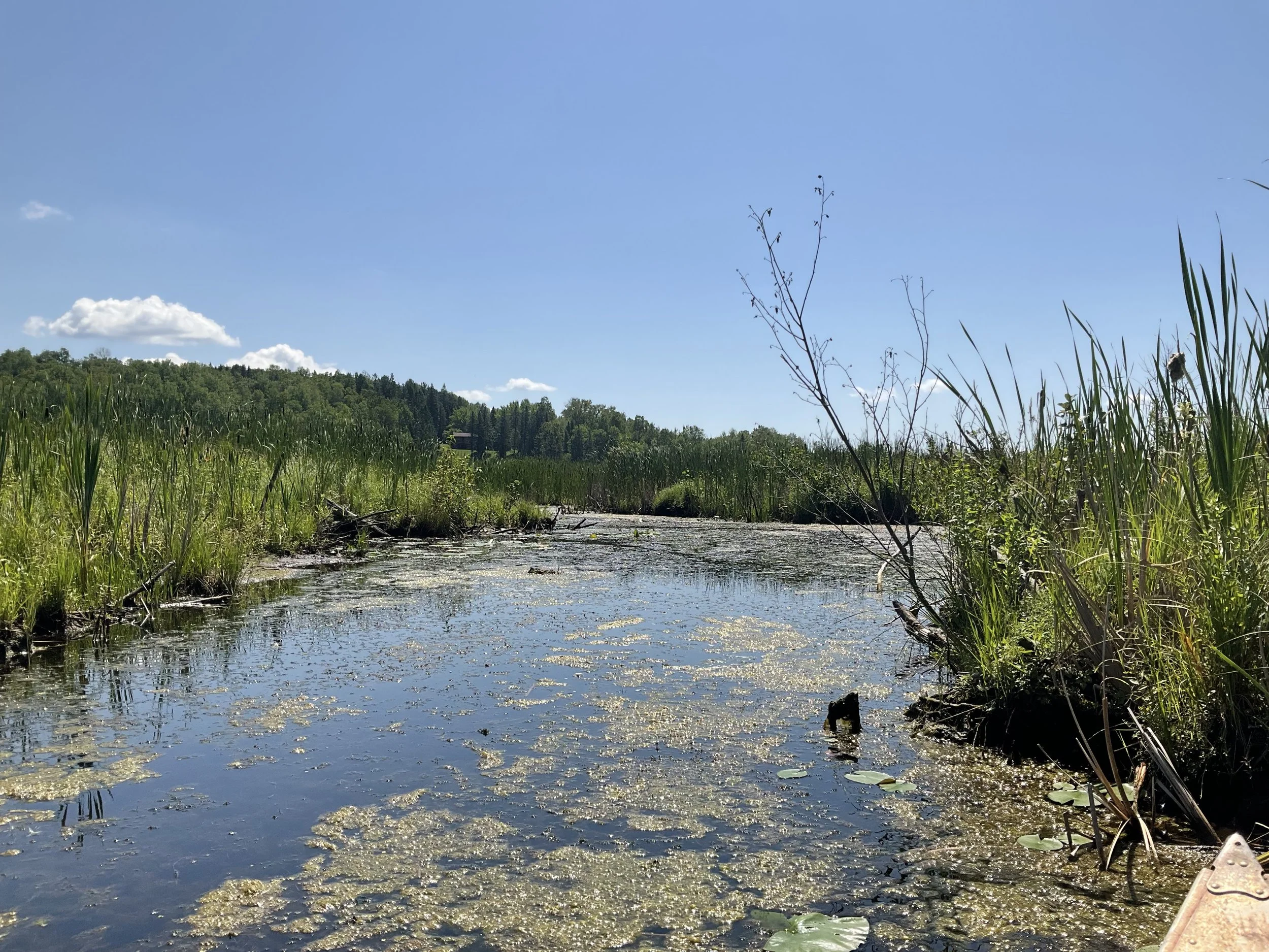
Photo: Perch Lake hemi-marsh. Photo credit: Minnesota Department of Natural Resources (MNDNR)
Perch Lake
Northland Constructors will start work this month to install a bridge on the Waabizeshikana Trail. After completion in December, water, animals, and people in small watercraft can move freely between Perch Lake and the St. Louis River. The trail will be closed in this area during construction.
For more information on this project, click here.

Photo: Channel restoration and bridge installation are well underway at Little Balsam Creek. Photo credit: Cedar Corporation.
Little Balsam Creek Fish Passage
A portion of the new stream channel and bridge have been constructed in Patzau, WI. This culvert replacement will remove the final fish passage barrier and open over 5 miles of Class 1 Trout Stream. The Gandy Dancer trail is detoured during the project.
For trail detour information, click here.

Photo: The reinforced channel at the Superior Waterfront Wetland project (Pickle Pond) is connected to wetland features and will continue to grow vegetation and become more naturalized. Photo credit: Wisconsin Department of Natural Resources (WDNR).
Superior Waterfront Wetland
(formerly known as Pickle Pond)
Shoreline restoration and plantings are complete and the construction of stormwater infrastructure is underway. Installation of a grit chamber will keep the new wetland areas cleaner and functioning properly. A temporary detour of a section of the Osaugie Trail will remain until work is done.
For more information on this project, click here.

Photo: C. Reiss Coal Slip. Photo credit: United States Army Corps of Engineers (USACE).
C. Reiss Coal Slip
About 20,000 cubic yards of contaminated sediment was removed & placed in an on-site containment facility. The project was designed by Stantec & constructed by JF Brennan, with USACE oversight. Funding came from the C. Reiss Co. & the Great Lakes Restoration Initiative, administered by USEPA.
Munger Landing
Nearby excavation work is planned to remove upland contaminated soil & sediment at Smithville Park. A small amount of tree clearing will start 9/16. Soil excavation & removal will begin 9/30 and be complete by the middle of October. Please stay off park trails marked by closed signs during this time.