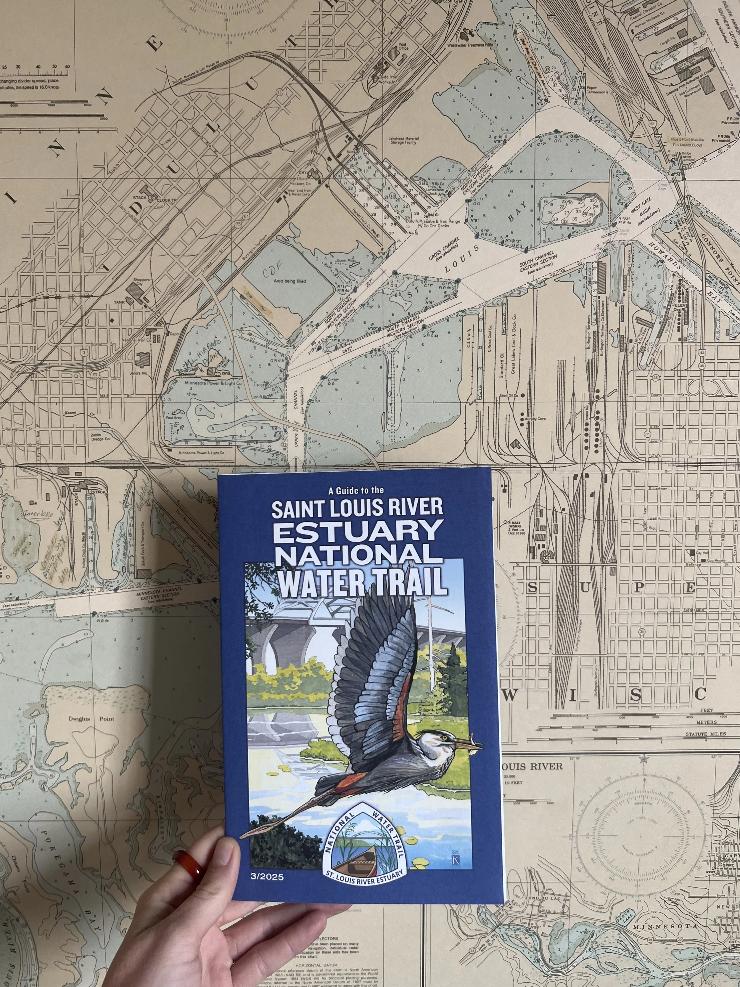
Water Trail Maps
Use the maps below to plan your adventure on the St. Louis River Estuary National Water Trail. These downloadable PDFs highlight route loops, access points, and key features to help you navigate with confidence.
Prefer a printed copy? Physical maps are available free of charge at dozens of local outfitters and partner locations, or you can stop by the St. Louis River Alliance office at 394 S Lake Ave., Suite 604 in Duluth.
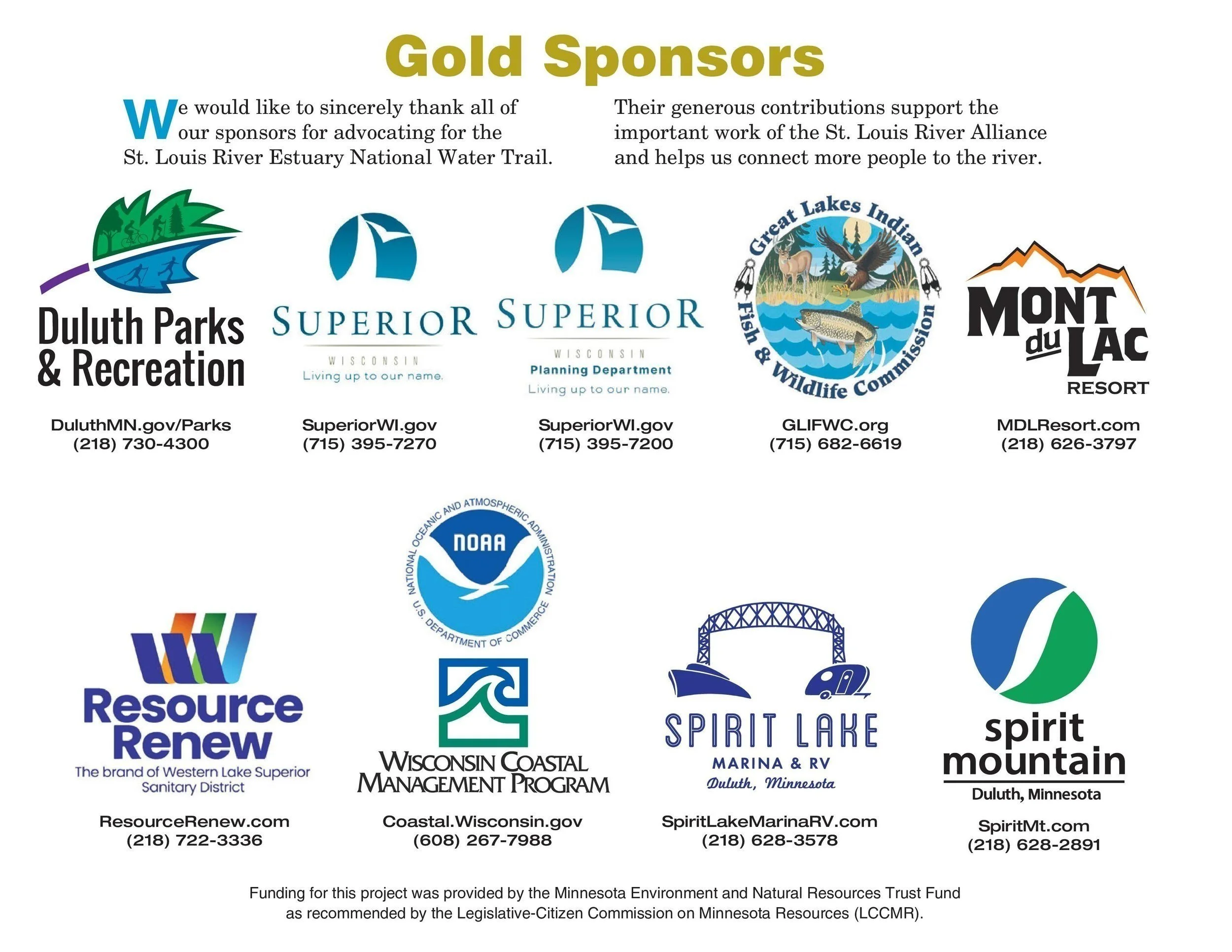
We extend our sincere thanks to the many partners and sponsors whose support helps make the Water Trail possible.
View & Download
Explore the Trail through our detailed, downloadable map panels.
Map PDFs are available below and are organized from west to east—beginning at the Fond du Lac Dam and ending before the harbor. Click on the individual panel you’d like to view. When the map opens in a new window, you can download and save it directly to your device for easy reference on your adventure.
MAP OVERVIEW
River history & ecology, Sponsors
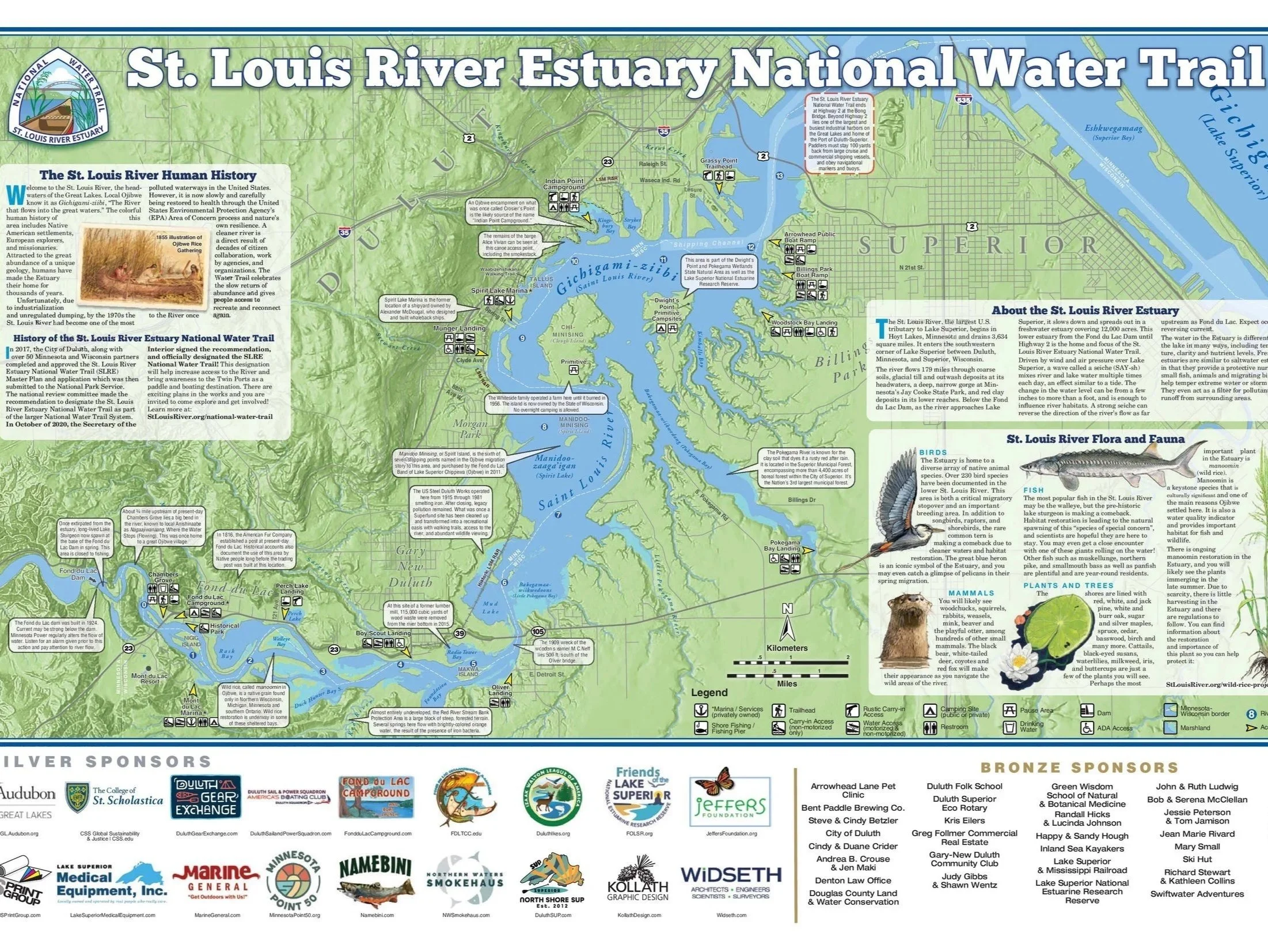
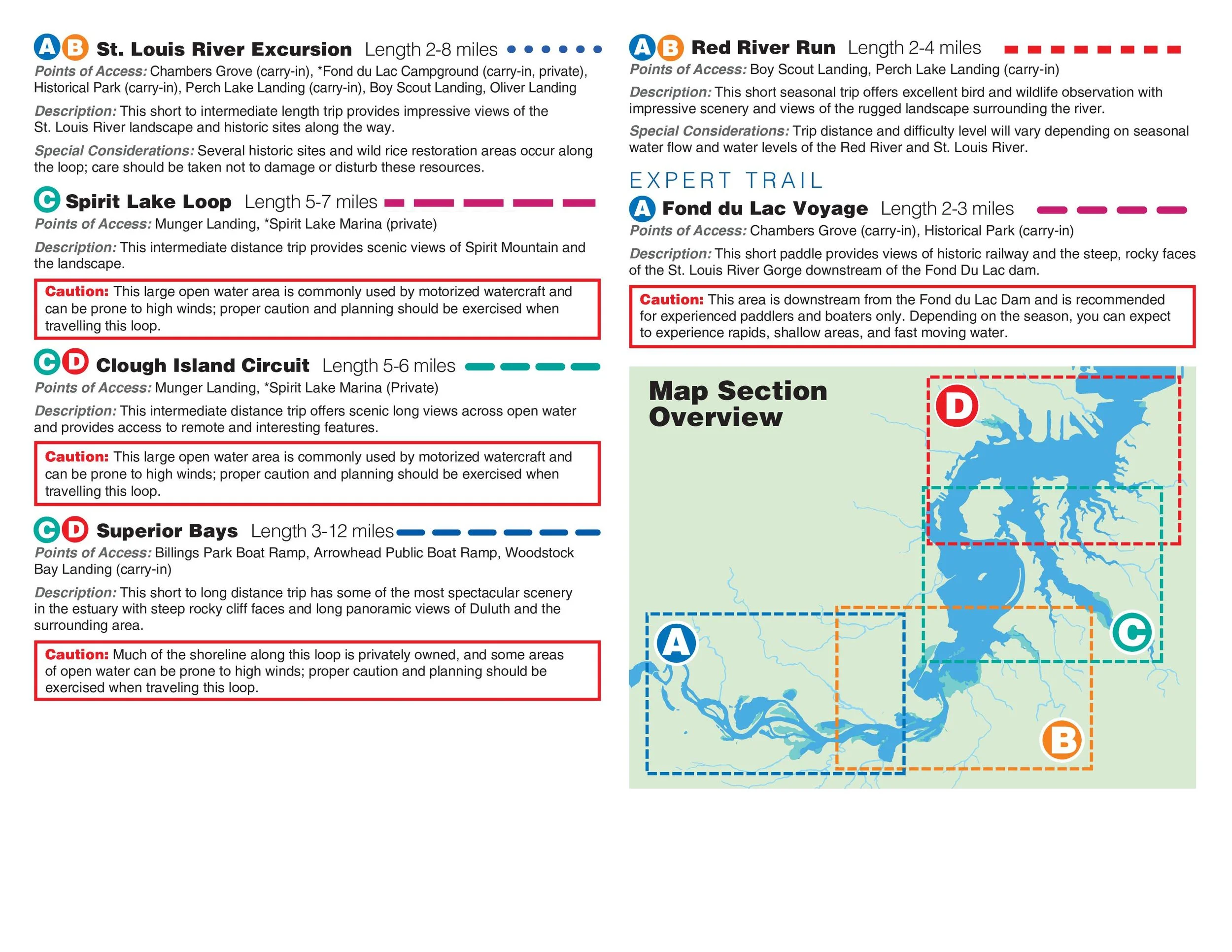
MAP INFO I
Safety, legend, novice & intermediate trails
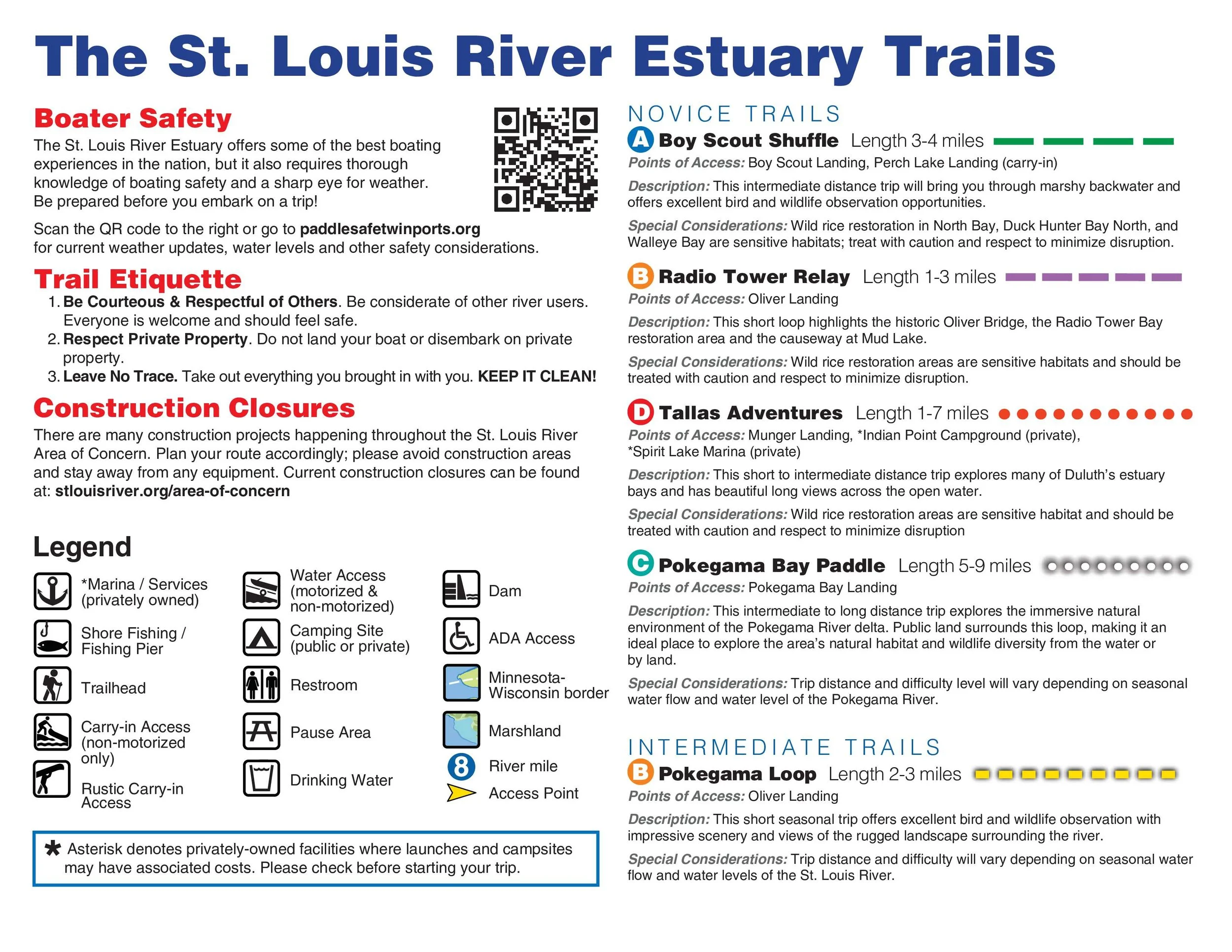
MAP INFO II
Intermediate & expert trails
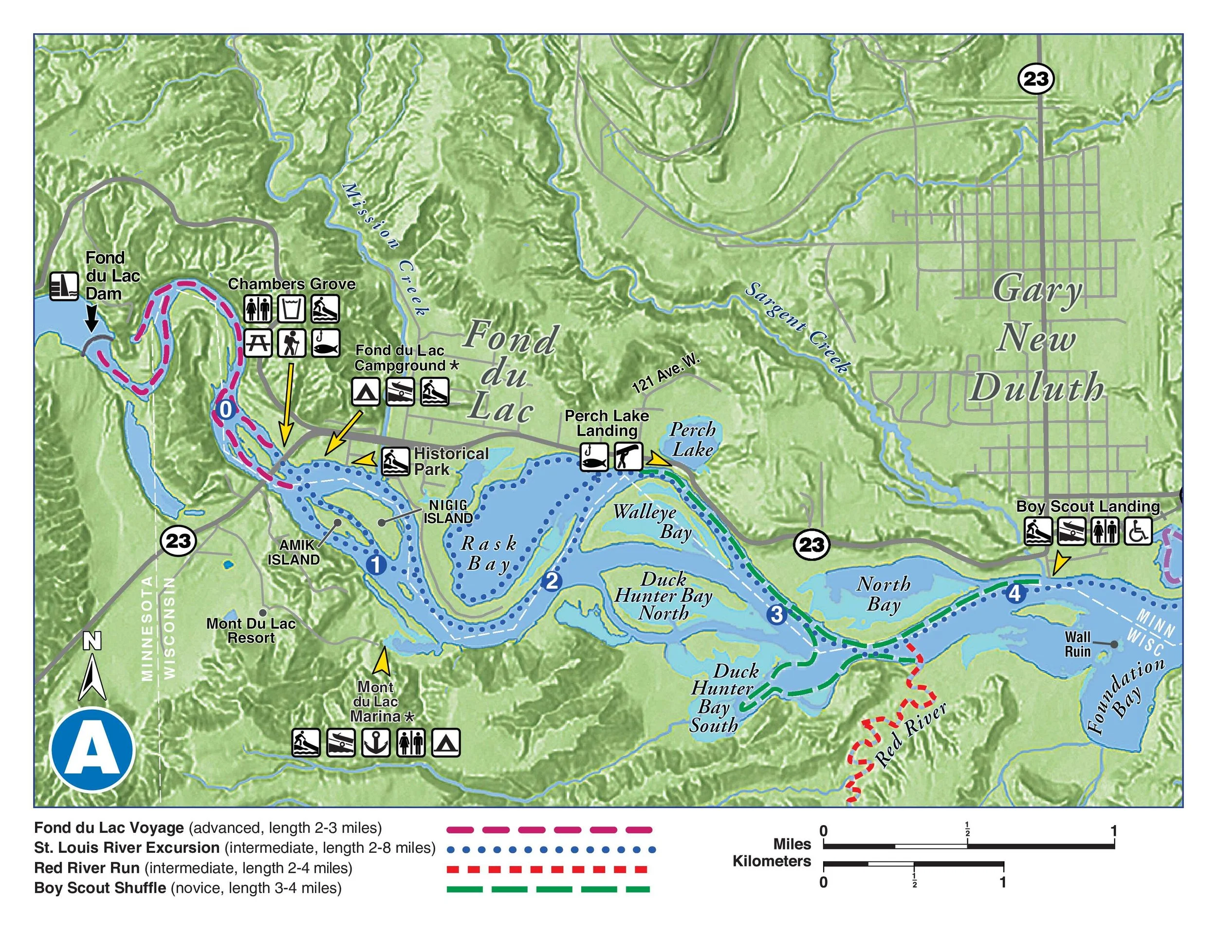
PANEL A
Neighborhoods: Fond du Lac, Gary-New Duluth
Landmarks: Chambers Grove Park, Perch Lake
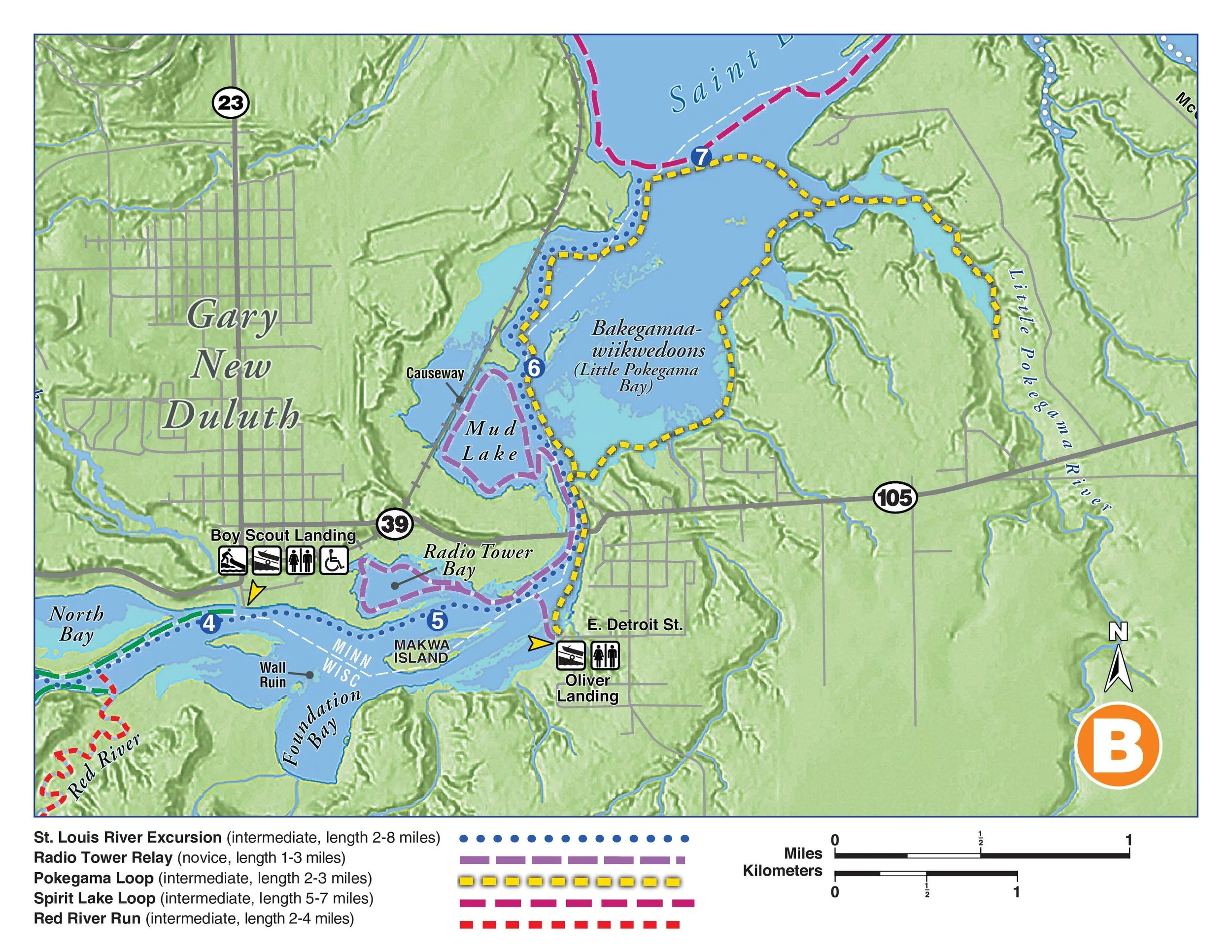
PANEL B
Neighborhoods: Gary-New Duluth, Oliver
Landmarks: Mud Lake, Oliver Bridge, Radio Tower Bay
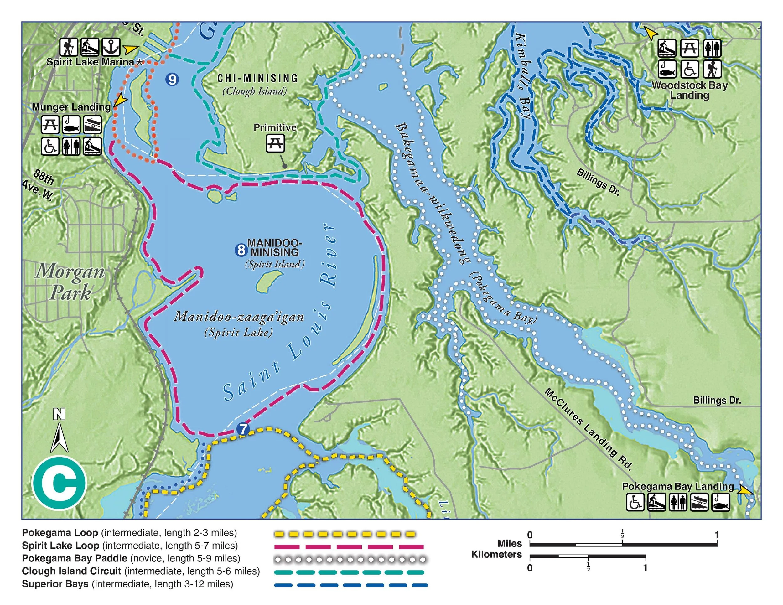
PANEL C
Neighborhoods: Morgan Park, Riverside, Billings Park
Landmarks: Spirit Lake, Clough Island, Pokegama Bay
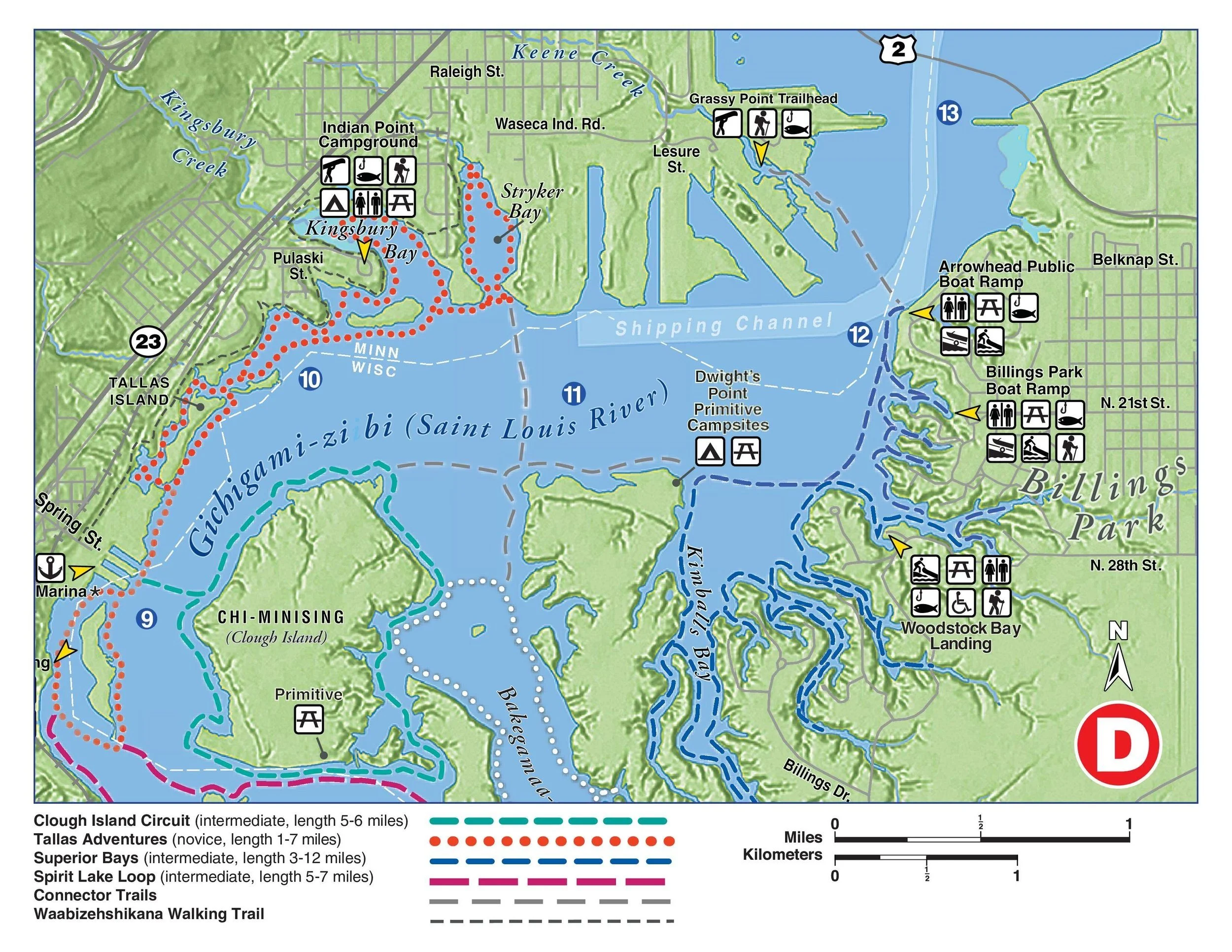
PANEL D
Neighborhoods: Riverside, Norton Park, Fairmont, Irving, Billings Park
Landmarks: Clough Island, Kingsbury Bay, Billings Park
FRONT/BACK COVER
About the St. Louis River Alliance

INSIDE PANEL
Gold Sponsors